
Assessment of agricultural production per area
Agriculture
Smart farming using the drone is state of the art of agriculture technology. We provided the NDVI map and other for helping you understand to the crop growing any state, Yield prediction, Disease maps and Estimation of fertilizer cost.
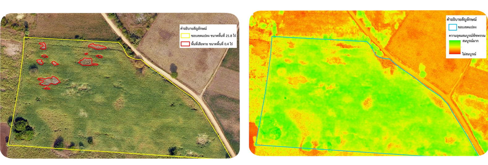
NDVI was used to determine plant health
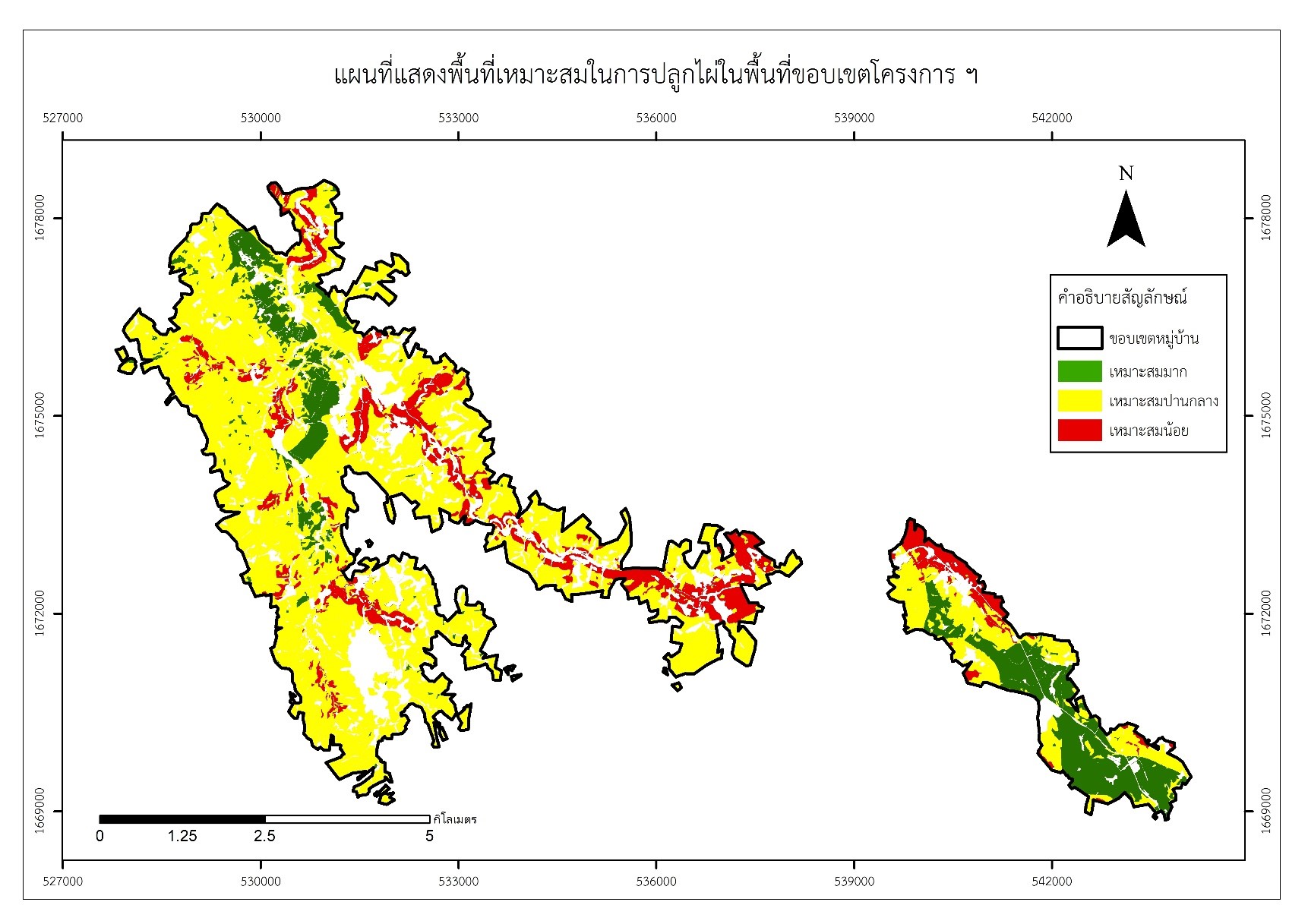
Land suitability evaluation for agricultural use using GIS, remote sensing techniques, and drone.