Drones
DRONES
We develop personalized solutions for aerial mapping, precision agriculture, infrastructure inspection and other needs with a focus on practicality, functionality and user-friendliness. To stay up-to-date, we curate our catalogue of drones and aerial services from our global network of partners, supported by our in-house team of researchers and technicians.
Enterprise Grade
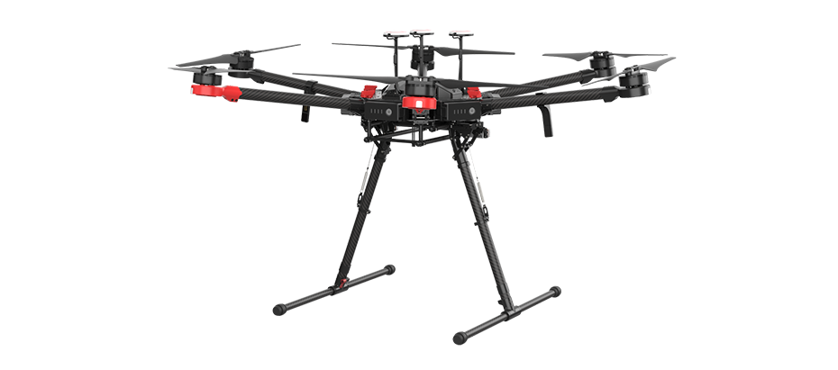
DJI Matrice 600 Pro
SIMPLY PROFESSIONAL PERFORMANCE The Matrice 600 Pro (M600 Pro) inherits everything from the M600 with improved flight performance and better loading capacity.Pre-installed arms and antennas reduce time required for setup, and the system’s modular design makes it easy to mount additional modules. The airframe is equipped with the latest DJI technologies, including the A3 Pro flight controller, Lightbridge 2 HD transmission system, Intelligent Batteries and Battery Management system. Several Zenmuse cameras and gimbals are natively compatible and full integration with third party software and hardware make the M600 Pro ideal for professional aerial photography and industrial applications.

DJI Matrice 300 RTK
The Matrice 300 RTK is DJI's latest commercial drone platform that takes inspiration from modern aviation systems. Offering up to 55 minutes of flight time, advanced Al capabilities, 6 Directional Sensing & Positioning and more, the M300 RTK sets a whole new standard by combining intelligence with high-performance and unrivaled reliability.
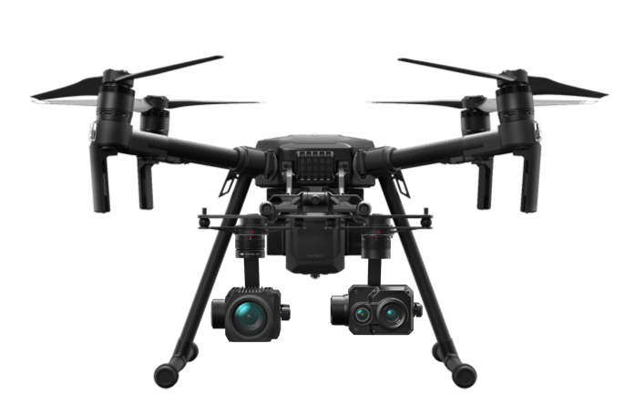
DJI Matrice 300 RTK
The ultimate platform for aerial productivity combines a rugged design and simple configurability to work as a solution for a variety of industrial applications. Improvements to the M200 Series V2 enhance intelligent control systems, flight performance, and add flight safety and data security features.
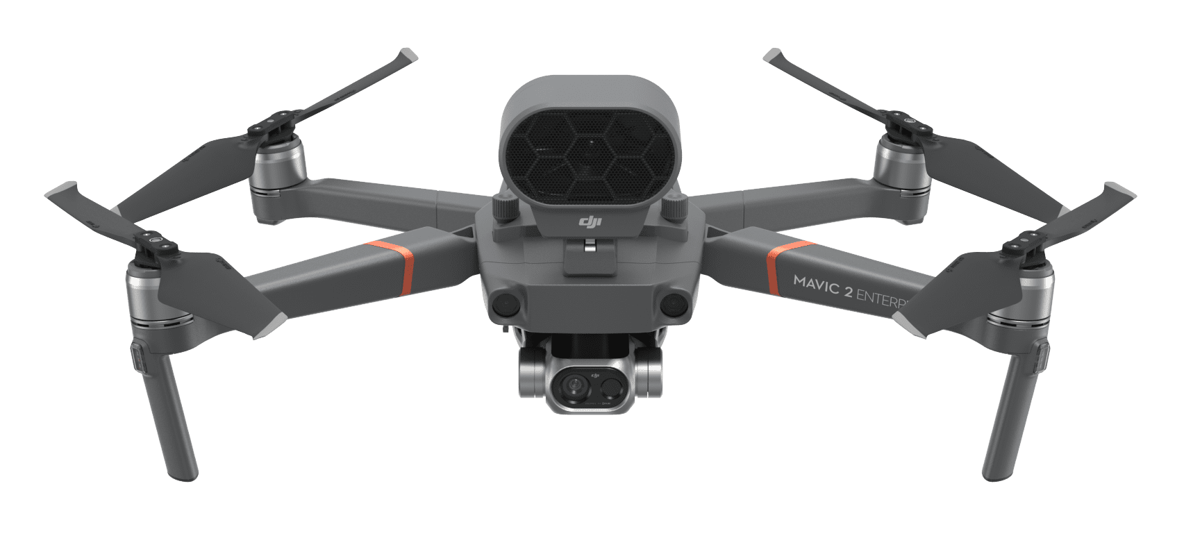
DJI Mavic 2 Enterprise Dual
Designed to empower a new generation of workers, the Mavic 2 Enterprise is the ultimate expression of a tool that delivers beyond expectation to meet current workplace challenges and future demands.
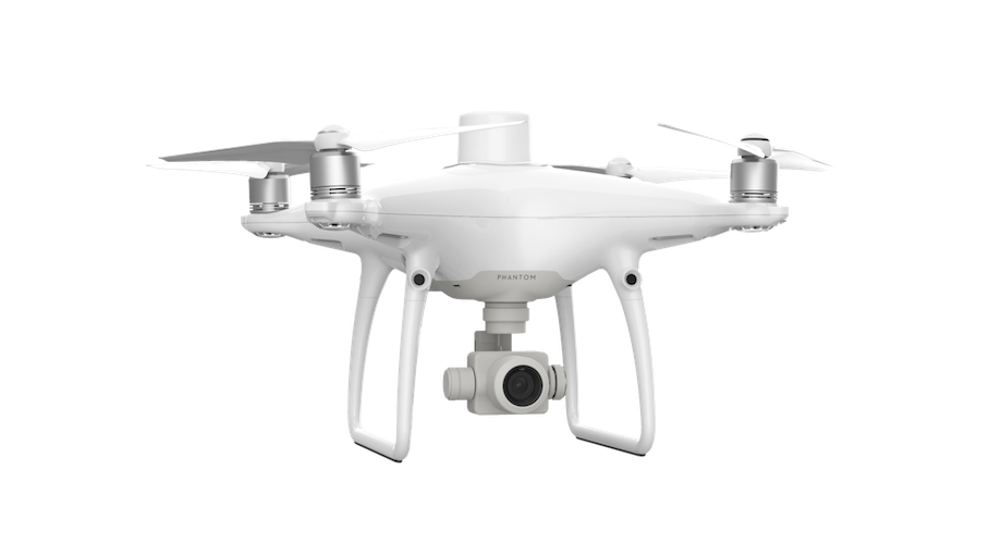
Phantom 4 RTK
Visionary Intelligence. Elevated Accuracy. Upgrade your next mapping mission with the Phantom 4 RTK – the most compact and accurate low altitude mapping solution.
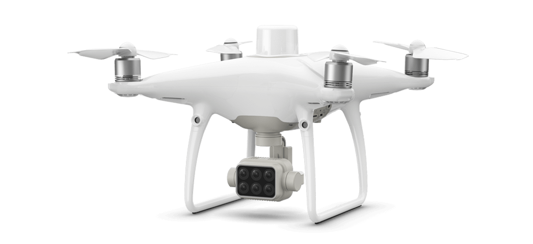
Phantom 4 Multispectral
Plant Intelligence for Targeted Action Gather precise plant-level data using the P4 Multispectral – a high-precision drone with a seamlessly integrated multispectral imaging system built for agriculture missions, environmental monitoring, and more.
Payload
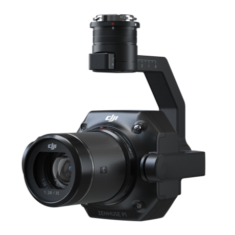
Zenmuse P1
The New Benchmark for Aerial Surveying The Zenmuse P1 integrates a full-frame sensor with interchangeable fixed-focus lenses on a 3-axis stabilized gimbal. Designed for photogrammetry flight missions, it takes efficiency and accuracy to a whole new level.
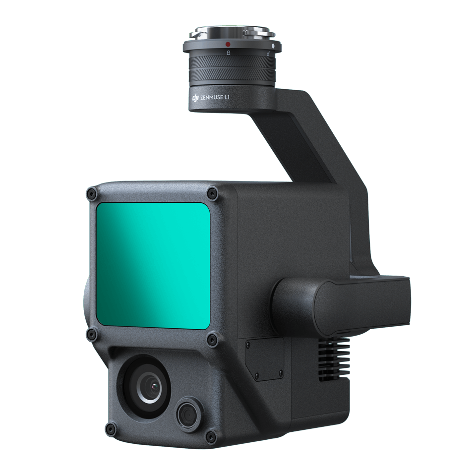
Zenmuse L1
A Lidar + RGB Solution for Aerial Surveying The Zenmuse L1 integrates a Livox Lidar module, a high-accuracy IMU, and a camera with a 1-inch CMOS on a 3-axis stabilized gimbal. When used with Matrice 300 RTK and DJI Terra, the L1 forms a complete solution that gives you real-time 3D data throughout the day, efficiently capturing the details of complex structures and delivering highly accurate reconstructed models.

Zenmuse H20 Series
“H” For Hybrid Multi-sensor payloads that bring a whole new meaning to mission efficiency. The unique intelligence and integrated design provide unprecedented aerial imaging capabilities for a range of commercial drone applications. Welcome to DJI’s first hybrid sensor solution – the Zenmuse H20 Series.
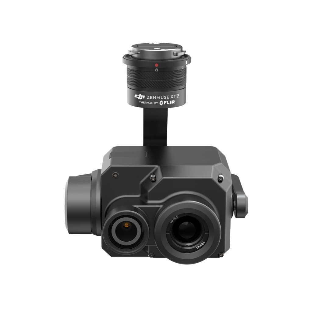
Zenmuse XT2
DUAL VISION. SUPERIOR INTELLIGENCE. Join the next generation of commercial drone solutions with the XT2. Pairing the FLIR Tau 2 thermal sensor and 4K visual camera with DJI’s leading stabilization and machine intelligence technology, the XT2 quickly transforms aerial data into powerful insights that save time, money – and lives.
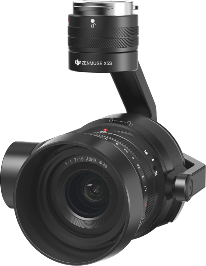
Zenmuse X5S
M4/3 camera that shoots 5.2K CinemaDNG and 4K Apple ProRes video.
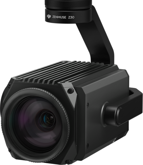
Zenmuse Z30
Integrated aerial camera with up to 30x optical zoom.
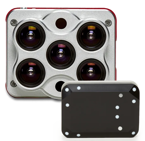
MicaSense Altum (RE)DEFINING AGRICULTURAL DRONE SENSING
SYNCHRONIZED THERMAL AND MULTISPECTRAL IMAGERY The MicaSense Altum captures six bands - red, green, blue, red edge, near-infrared and thermal. The capture of these bands happens at the same moment, making the data easier to align and use for analytics. Also, because there are six bands, data from Altum can be used to create anything from NDVI to digital surface models to thermal heat maps.
KEY FEATURES
CALIBRATED THERMAL SENSOR
Capture aligned multispectral and thermal imagery in one flight using only one sensor.
HI-RES MULTISPECTRAL
Improved resolution means more accurate digital surface models, easier stitching at lower altitudes, and better plant classification and plant counting.
HI-RES RGB
Five high-resolution lenses mean you get detailed plant health imagery (5.2 cm GSD) and detailed Digital Surface Models all from 400 ft.
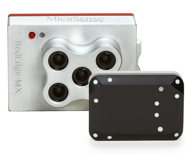
MicaSense RedEdge-MX
CALIBRATED MULTISPECTRAL IMAGERY RedEdge-MX is one of the most flexible solutions on the market, with optimized GSD (resolution), the new DLS 2 light sensor, a global shutter for distortion-free images, the ability to generate plant health indexes and RGB (color) images from one flight, and the freedom of platform-agnostic data. All in a compact size and low weight that allow it to be used with a wide variety of unmanned aircraft systems.
KEY FEATURES
CALIBRATED THERMAL SENSOR
Five narrow high resolution (8 cm/pixel at 400 ft) spectral bands captured during one flight. Calibrated for precise, repeatable measurements.
RUGGED AND DURABLE
New aluminum body for better durability and performance in higher temperatures. Global shutter imagers - no gimbal required and no moving parts.
FULL FLEXIBILITY
Compact size allows for integration with a wide variety of drones. Full access to raw data; outputs can be generated using a wide variety of processing and analysis platforms.