ABOUT US

DevDroneMapper
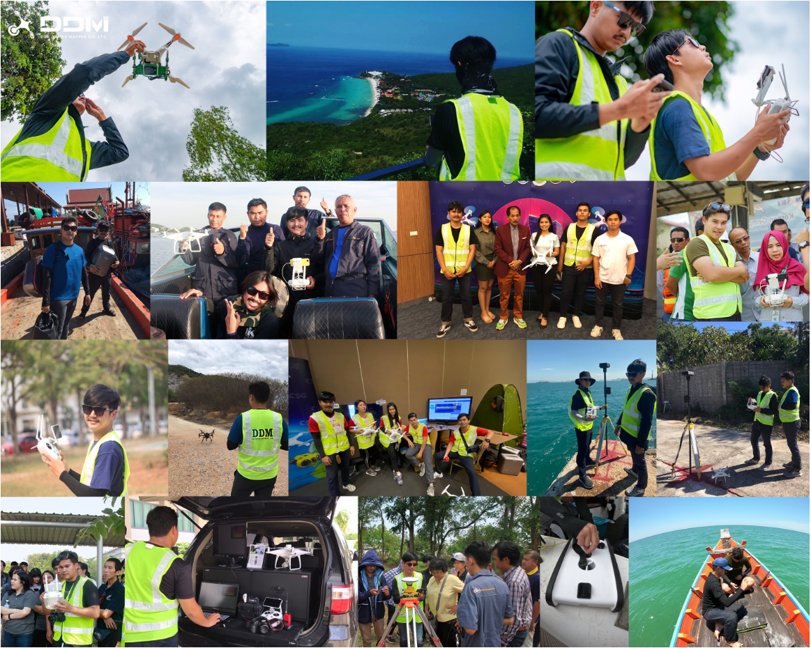
DDM provides innovative solutions of aerial, water surface & ground surveying. Nowadays, Drone comes with its Artificial Intelligence (AI) brain and eyes. Drone images become more valuable with Data Science Technology. It is possible to discover insights from the Drone images. Our experts build particular solutions: Precision Farming, Renewable Energy Management, Environmental Monitoring, Disaster Management, Smart City.
- "Dev" is a development of novel technique.
- "Drone" is a small & efficient robot to acquire the Data.
- "Mapper" is an expert team who builds intelligence maps.
All together creates the new term named "Dev Drone Mapper".
We provide intelligence mapping services
by integrating Drone and Data Science technologies.
We are not only expert in Drone but also in special equipment such as Multi-spectral, Thermal, Street View camera.
OUR TEAM
Starting from a research group of Faculty of Geo-Informatics, Burapha University., THAILAND, there are presently 6 permanent staffs and 10+ graduated students as temporary staffs.
Kitsanai Charoenjit, PhD
Kitsanai Charoenjit specializes in remote sensing data analysis, encompassing satellite imagery and data obtained from aerial drones (Earth Observation Satellite and Drone). His expertise lies in geoinformation science for the development of natural resources and the environment (Geoinformation Science for Natural Resource and Environmental Development). Additionally, Kitsanai is well-versed in spatial data sciences, with a focus on the scientific aspects of spatial information (Spatial Data Sciences).
Narut Soontranon, PhD
Narut is co-founder of Dev Drone Mapper, who has passionate about data and image analytics. He is currently responsible in several Data Science and Computer Vision projects. In 2013-2017, he was a researcher at GISTDA who involved in Precision Farming, Disaster Management, Field/Drone Data Processing. In 2010-2013, he was a PhD candidate at IGN (French Mapping Agency), especially focused on "3D reconstruction using modern photogrammetry". He is Invited as a guest lecturer on Data Science, Computer Vision/Image processing topics in major universities in Thailand.

Surangkana Tanoi
In 2018, Surangkana has joined DDM team as a Sales Coordinator. She is responsible in customer relationship management (both existing and new customers). She is interested in applying Drone and Geo-spatial Data services to the real world. Her expertises is not only sales & marketing but also financial planning. She could provide suitable products & services for supporting your business. If you are curious about DDM products, you may need to speak with her!
Nuttawut Bunta
Nuttawut obtained his bachelor's degree in Geo-informatic from Burapha University. He is interested in the robots & drone equipment repair & maintenance. He also conducts several field works for data acquisition. With his experience, it could be ensured that the high quality data will be acquired from the fields. His expertise is not only data acquisition but also data processing tools. By giving drone data, he could provide you the effective data products (for examples: Orthomosaic map , Digital Surface Model, 3D Model)

Panithan Kumthonchaiphimol
Panithan obtained his bachelor's degree in Geo-informatic from Burapha University. His experiences are related to Geo-spatial data processing & analytics, GIS. The data can be obtained from aerial or underwater drone, satellite images, IoT devices. He has conducted several projects to serve different industries: for example: agricultural, environmental monitoring, disaster management, oil & gas, mining, wind turbine inspection, etc.
OUR Client