Services & Consult

Services & Consult

WORKING

Data Collection

Conduct field surveys and inspection using the following tools: Image satellite, Drone,
Mobile mapping, Under water drone and Weather station.

Process

Collect data from the field and processing on Cloud and Desktop. As well as to prepare the data in the form of geo-informatics.

Analyze

Analyze data for application in management of disasters, forests, environment, agriculture, urban planning, construction and energy.

Report Map patrol

Prepare a report in the format of Output Map report and interactive map portal.

Forestry

Together Drone & Earth Observation Satellite (EOS) can be used to develop an application for sustainable development. Image Classification using Object based image analysis, Change detection, Time series analysis and Mapping.
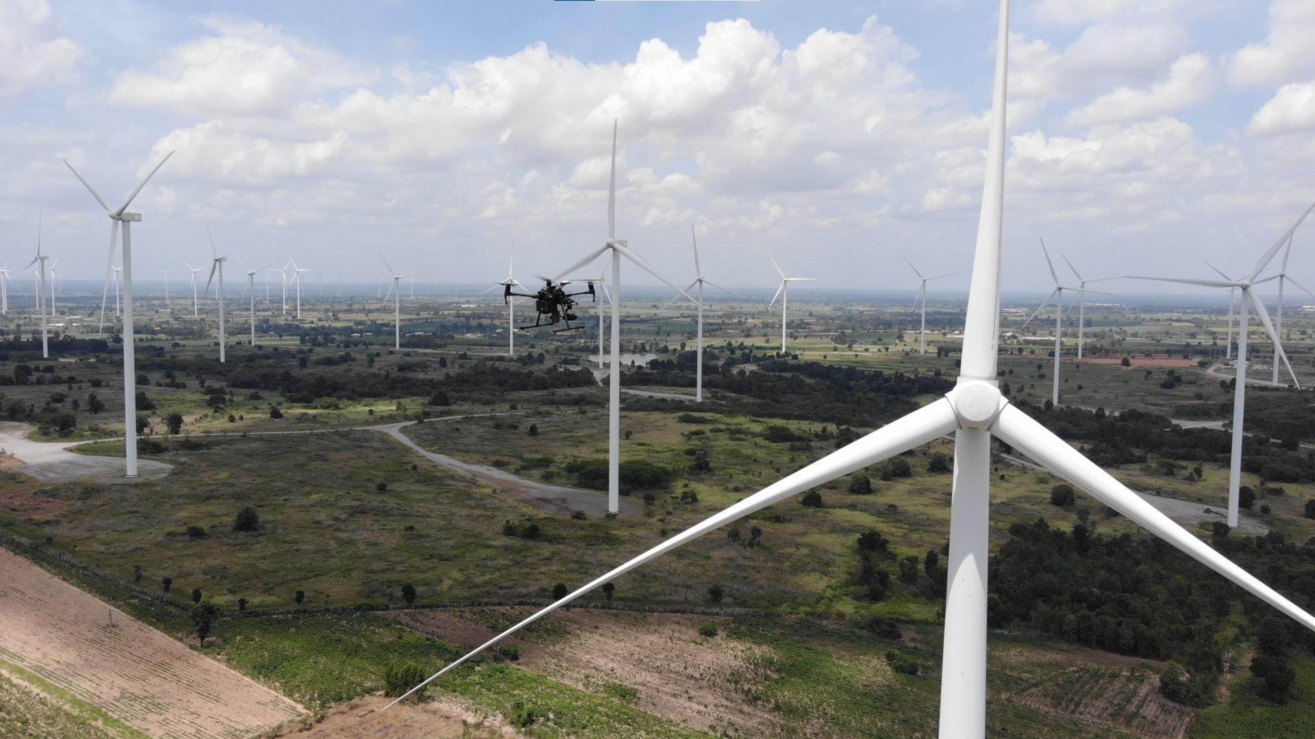
Energy

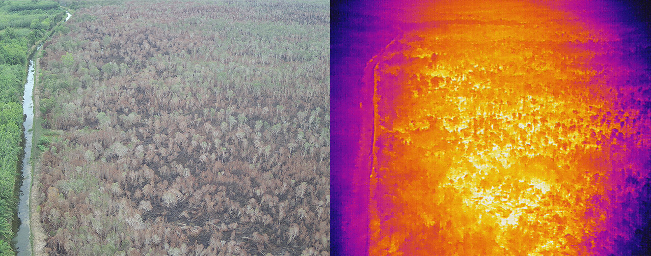
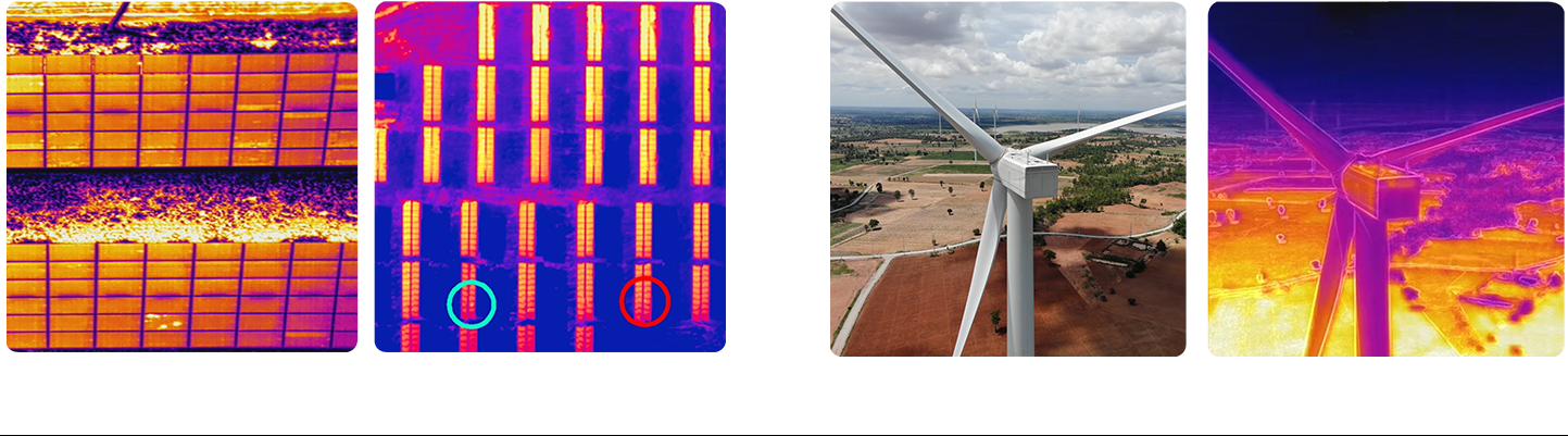
Thermal camera is used for deeply investigation. With the thermal infrared range (7.5 – 13.5 μm​), several applications become possible: Homeland security, Firefighting, Industrial area monitoring.


Marine

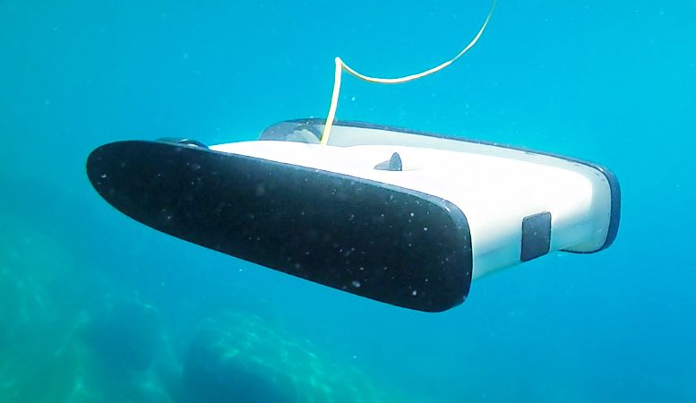
Modern underwater drones are like miniature submarines without crew. These submarine drones are challenging to send radio signals to. They can be autonomous, using their onboard sensors to function. Another method is a long tether that allows for a direct connection between ship and drone.


Using underwater drones to monitor underwater plant species

Those with infrastructure underwater also use them. Drones are used to monitor building underwater and help provide oil and other essential services to society. These drones are durable enough for multiple deployments.


Geology

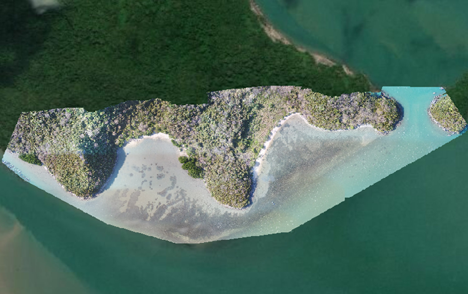
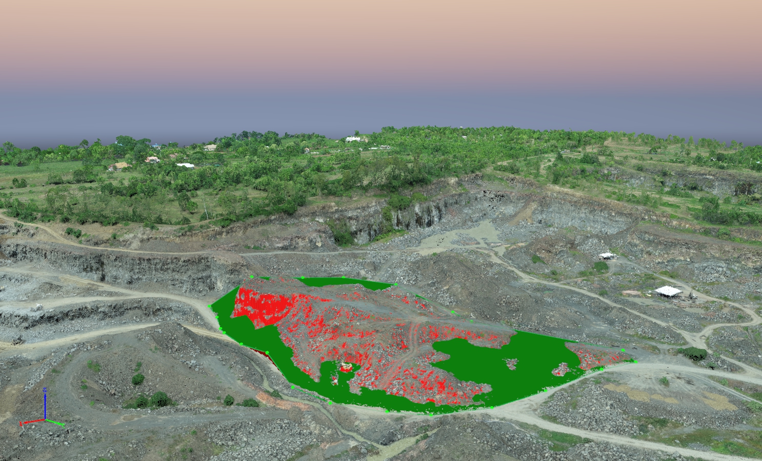
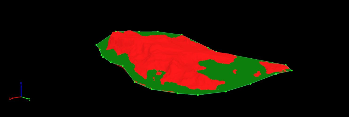
Using overlapping images, a new method of metering provides a 3D cloud point for generating DEMs, shapes, volumetric measurements, mapping for high-quality data. Active devices (LiDAR) can provide 3 models. More efficient dimensions.

Security

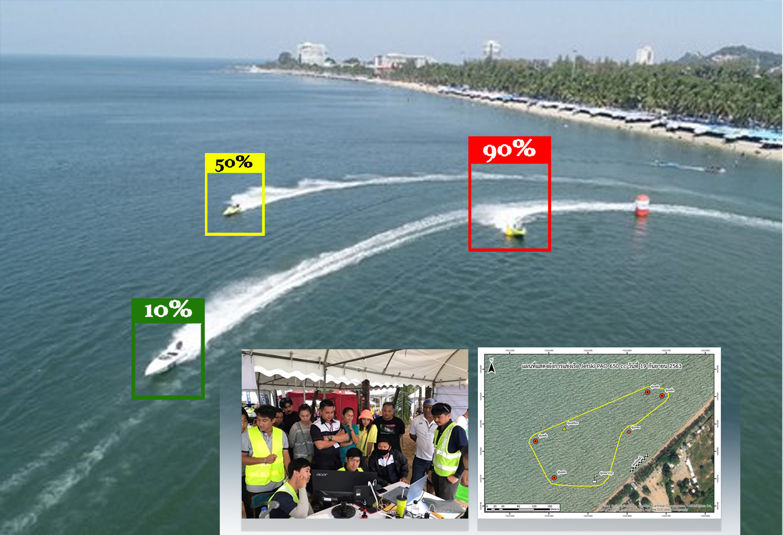
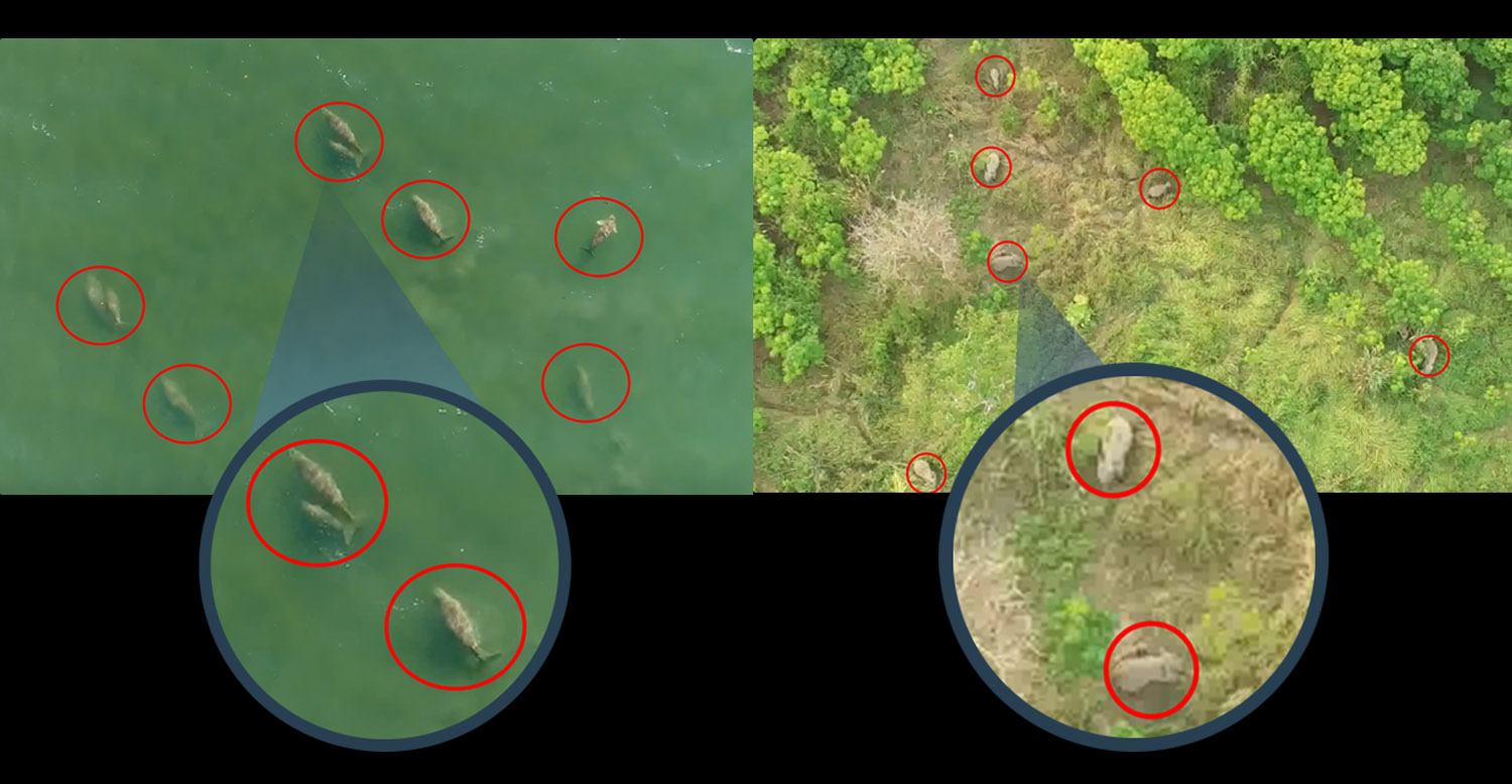
Search and Rescue is among the industries heavily affected by the use of drones. Search times can be significantly reduced while limiting potential risk to the party being rescued as well as rescuers. There are many options and benefits to using drones for search and rescue.


Electricity

Power line inspection

Drones can be used to inspect power lines and power pylons for bird’s nests, lightning strikes, rust/corrosion and damaged bolts.  Our drone solution system takes into account the magnetic interference of the power lines which affects the drone compass. Therefore, we can fly extremely close to the power lines, and as a result provide high resolution images and data, useful in the optimisation of your maintenance plan.

Animal and plant protection

We have developed a new methodology around the use of small and mid-size drones in marine research including survey design, data collection and processing as well as the analysis of data. The exciting outcome is that we are starting to develop some detailed maps around dugong population numbers and density.

Agricultures

Smart farming using the drone is state of the art of agriculture technology. We provided the NDVI map and other for helping you understand to the crop growing any state, Yield prediction, Disease maps and Estimation of fertilizer cost.

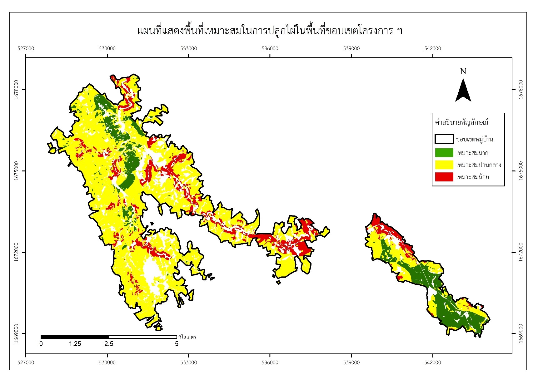
Land suitability evaluation for agricultural use using GIS, remote sensing techniques, and drone.


Land

Drone data creates accurate 2D and 3D models that integrate seamlessly with local geographic information systems, helping teams visualize results.

Quickly take off and fly over cities or rural areas to capture data using automated flights, reducing costs and cutting fieldwork hours.Create 3D models with accurate, geo-referenced data that can be readily fitted into the BIM models to visualize designs.The 3D models generated using photogrammetry software are compatible with a variety of GIS software, streamlining the planning process.


Environmental protection

Drones, are becoming popular platforms for spatial assessment of ecological phenomena. These remote sensing platforms have the capacity for acquiring imagery of very fine spatial resolution, have increased flexibility for image acquisition, and generally have lower operational costs. For seagrass habitat assessment, very fine resolution UAS imagery has been effective for density coverage mapping and detecting changes in small patch and landscape features that would not be possible with satellite or aerial photography.

GIS Spatial Data

Drones provide construction teams with an overhead view of jobsites, materials, machinery and people. Contractors are using the autonomous flying machines to record images and videos that help optimize everything from grading plans and operations to identifying differences between as-designed and as-built site plans

Geo-referenced aerial images with resolutions down to less than 1 cm (0.4 in), which are transformed into point clouds with millions of data points for each single flight. Even more time can be saved by using the survey grade equipped with PPK (Post processed kinematics), which enables you to achieve absolute X, Y, Z accuracies down to 1 cm (0.4 in), with fewer to no Ground Control Points needed.

igns.The 3D models generated using photogrammetry software are compatible with a variety of GIS software, streamlining the planning process.

Geo Spatial Data

The FGDS framework is a set of essential data themes which are the building blocks for planning and design of a national spatial data infrastructure. There already exist international data model standards that address many of the fundamental data topics that will be developed through large. Because these models reflect the experiences and results of trial-and-error to many considerations by a broad group of users, they are often quite comprehensive, large and complicated.